3D

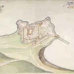
A colored ground plot of the castle of Mont Orgueil; drawn in 1680, by Thomas Phillips, on a scale of 55 feet to an inch.
Accompanying this map of "an accompt taken of all the ordnance, etc., in Mount Argile Castle in his Mats. island of Jersey; likewise how and where mounted, by Capt. Richard Leake, Master Gunner of England, with his opinion what alteration or addition may be made to the same." June 3rd, 1680
The British Library1680

