Document

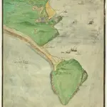
A Coloured Plan of the Isle of Portland and Weymouth Bay
This is a map of the coastal area of Portland Bill and Weymouth. It dates from around 1590 and may be the work of Robert Adams, a surveyor with a reputation for producing carefully drawn maps of towns and districts in England and the Low Countries. The coastline with its cliffs, beaches and tributaries is carefully recorded. At this time the security of England threatened by the Anglo-Spanish war. Raids on transatlantic shipping by English seamen such as Francis Drake and England’s support of the Protestant rebellion in the Spanish ruled Netherlands had induced the Catholic Philip II to launch the Spanish Armada in 1588. Although the Armada was defeated by the English in August of that year, England remained at war with Spain for many years to come. Further attempts to invade were made by Philip of Spain, with the dispersal of a second Armada’ in October 1596 and the assembly of the third Armada’ in the following spring. In this climate it was naturally coastal areas that were under the closest scrutiny. Topographical features are recorded pictorially with Weymouth shown in great detail with the church and sea walls discernable. Portland and Sandsfoot castles are also shown. These were built by Henry VIII during the 1539-40 threat from the combined forces of France and Spain Francis I of France and Charles V, Holy Roman Emperor and King of Spain signed a peace treaty. The castles provided essential protection of the vulnerable sea lanes of the area.
The British LibraryAdams, Robert
1590

