Document

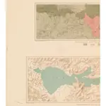
Geological Map of the Knoxville District/ Topographical Map of the Region of Clear Lake
"Contour interval 25 feet." Oriented with north toward the upper left. Also on sheet "Topographical map of the region of Clear Lake" ; compiled by C.F. Hoffmann; scale ca. 1:96,000. "Geo. F. Becker, Geologist in charge."
UCLA LibraryHoffmann, C. F. (Charles Frederick), 1838-1913.; Hoffmann, J. D.
1885
Geological Survey (U.S.)
1:15 000

