Document

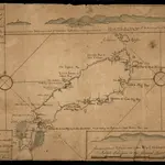
Map Of Tobago Showing Native Dwellings
Map of Tobago as it was in the year 1756. Rocks and other obstructions off the coast are marked with crosses and the depth of the water in the harbours is shown in fathoms. The names of the larger bays are given in both English and French. Along the upper edge of the map is a coastal view of the north east of the island and along the lower edge is the coast line of the south west. The map carries the annotations, ?On this Rock his Majesty's Ship Chesterfield Struck having XV Fathom the Cast Before. Anno 1749.? and ?The French Fort Burnt in 1749.?
The British Library1756
1756

